Many thanks to all of the dedicated trail builders and volunteers, the Kootenays are full of world class trails for all who wish to roam & roll our regional trails.
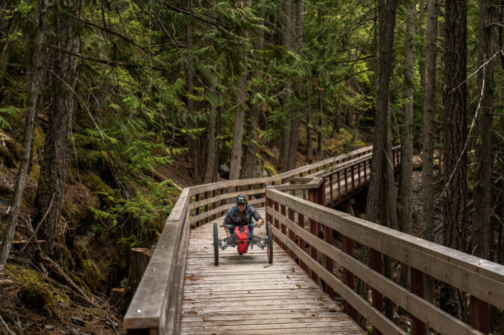
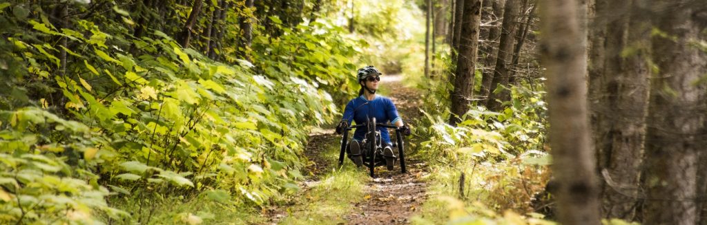
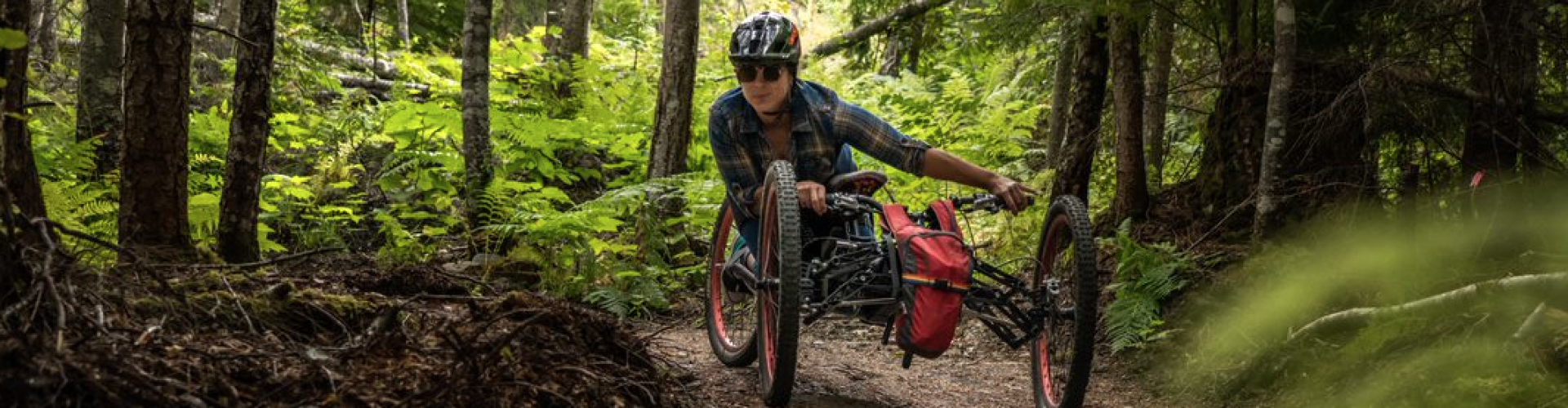
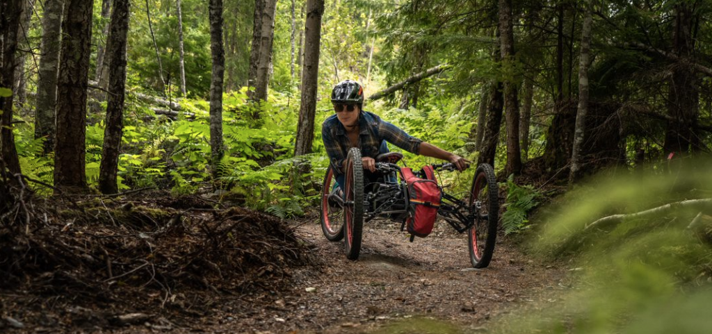
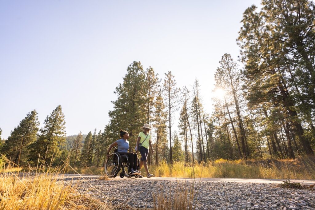
Spearheading a movement to ensure adaptive bikes (often with three or four wheels), and wheelchairs can use these trails is the Kootenay Adaptive Sport Association (KASA), a non-profit organization in Nakusp, BC.
Below is a list of some of the accessible trails in the Kootenays, in the Birthplace of Adventure:
CASTLEGAR
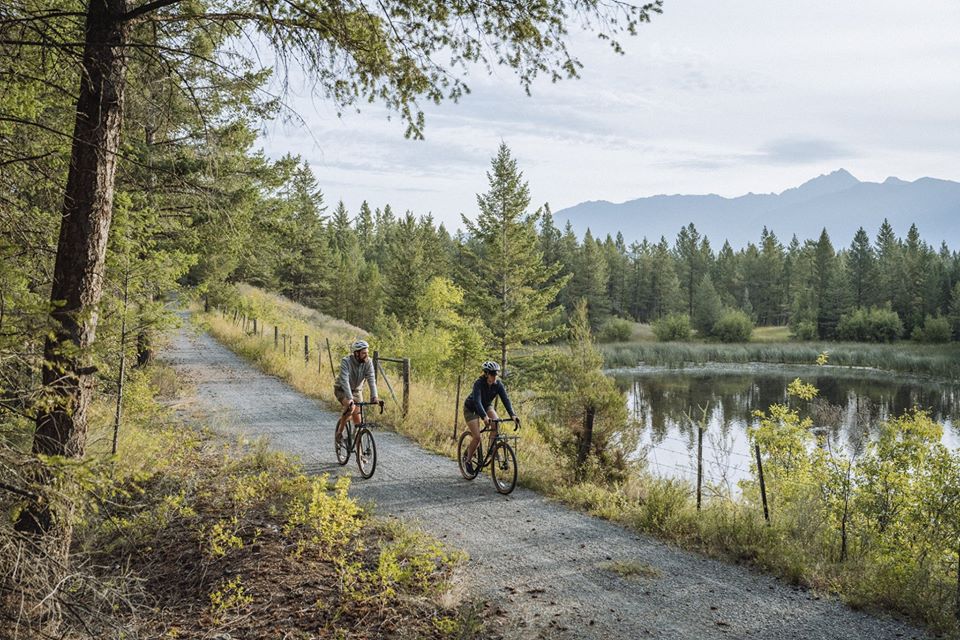
Part of the Trans Canada Trail, the Columbia & Western Rail Trail is an impressive 162-km, one-way (100-mi) ride from Castlegar to Midway. Within the section from Christina Lake to Castlegar this portion (88-km, one-way | 55-mi) of the ride, you’ll experience several massive steel trestles span deep ravines, and substantial stone walls secure the rail bed to the terrain. There is a sequence of short tunnels that culminate at the entrance to the impressive 912-metre Bull Dog Tunnel, where the railway abruptly turns away from the lovely Arrow Lake Valley. (Note: Watch for logging trucks in the tunnel, as there is active reforestation efforts happening).
COLUMBIA VALLEY/INVERMERE
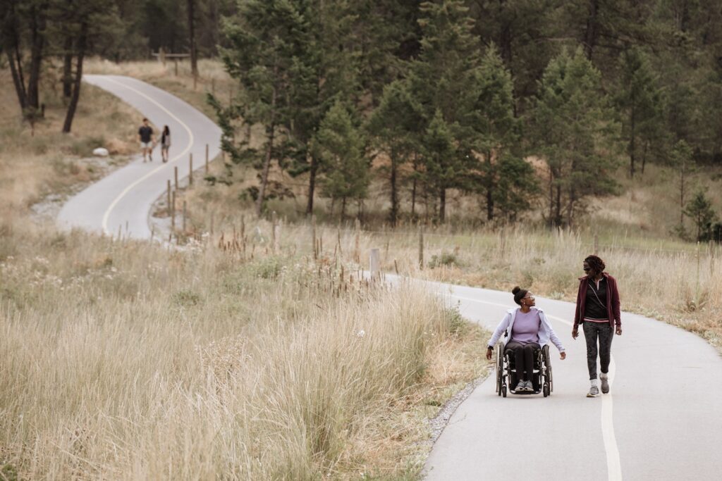
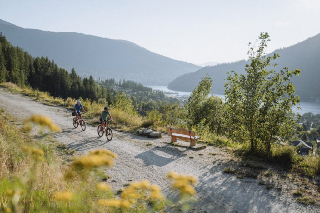
The Markin-McPhail Westside Legacy Trail, between Fairmont Hot Springs and Invermere, is another paved-route (25-km, one-way | 15.5-mi). This wonderful paved path with scenic picnic opportunities along the way. Seventeen benches, or rest areas dot the trail on particularly beautiful sections, some overlooking Windermere Lake. Pause your outing at one of these spots and enjoy some nature – the trail also meets four small creeks and a large beaver pond.
CRANBROOK | KIMBERLEY
The Chief Isadore Rail Trail from Cranbrook to Mayook (34-km, round-trip | 21-mi) offers breathtaking views of the Rocky Mountains. It has a packed gravel surface, which is half on old Rail Grade and half new trail. (At the 17-km ‘Mayook Trail’ section the new trail switches to an enhanced single track to the end of the trail at Wardner, an additional 26.5-km, one-way).
The Northstar Rails to Trails stretches over 26-km, one-way (16-mi) and links the cities of Kimberley and Cranbrook. The trail is nestled between the Purcell Mountains and the Rocky Mountain Trench in southeastern British Columbia. The area is naturally beautiful surrounded by mountains dotted with forests and grasslands, broken up by lakes and rivers.
FERNIE
The Easy Beaver Trail, in Fernie, serves as an adaptable path, bridging Montane Parkway with Montane Hut. With its broad and accessible terrain, it invites trail users of all skill levels, providing them an opportunity to soak in the awe-inspiring vistas of the Lizard Range.
Introducing the newly constructed Fernie Valley Pathway aiding accessibility; this path forms a significant addition to the Recreational Trail System of Fernie. The pathway, with a generous breadth of 2-meters and a substantial length of 5.3-km, stretches virtually the entire length. The journey commences at our Fernie Visitor Centre complementing the picturesque Annex Park on its route.
GOLDEN & GLACIER NATIONAL PARK
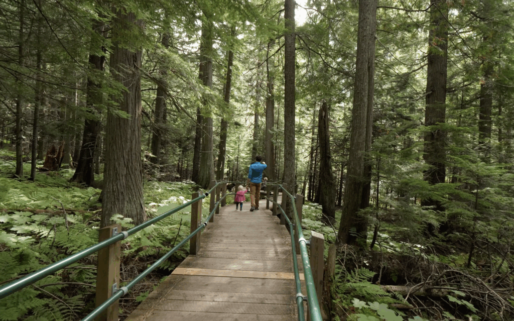
The Hemlock Grove Boardwalk and Picnic Area in Glacier National Park has been designed to barrier free standards. The Hemlock Grove Boardwalk trail was developed as a legacy of the Man in Motion World Tour visit. This short 400-metre barrier-free boardwalk offers a rainforest experience to people with mobility disabilities, people with visual impairments and people with other limitations on movement, such as seniors and even visitors with baby strollers. (An all-terrain wheelchair is available for loan at the Illecillewaet Campground welcome stations.)
Explore the 10-km circular Golden Rotary Trail, which enables you to jump on (or off) anywhere along this well-marked trail. It is typically requires an average completion time of 2.5-hours to complete the loop. The Rotary Trail is purposefully structured to emphasize on the beauty of the Kicking Horse and Columbia rivers, making them easily accessible to all. Please note that while dogs are permitted, they must remain leashed for the duration of the visit.
NEW DENVER
The Galena Trail, former CPR rail line built in 1895 is a 13-km, one-way (8-mi) ride from Rosebery (near New Denver) to Three Forks (near Sandon) railway line. Offering three entry locations, the Galena Trail provides a unique opportunity to customize your experience according to your preferences and time constraints. For those seeking the exhilarating experience of a Carpenter Creek cable car, the Three Forks section comes highly recommended. Alternatively, an easier ride with picturesque views of the lake and mountains can be found on the Rosebery track.
NAKUSP
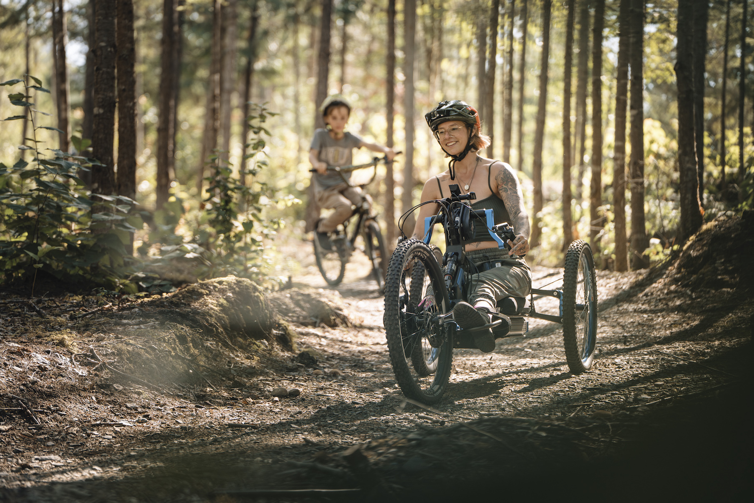
Mt. Abriel Mountain Biking Trails is a booming mountain bike destination near Nakusp, complete with multiple trails, a campground, bike park, and shelters. The creators of the trail network have a goal of breaking barriers between able-bodied riders, adaptive riders, experts, beginners, and children.
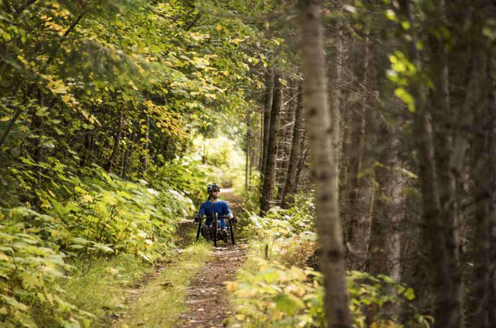
The Spine Trail, in New Denver, is a beautiful swoopy downhill, about 3-km, return (1.8-mi), for adaptive mountain bikes and was created by the North Slocan Trail Association.
NELSON KOOTENAY LAKE
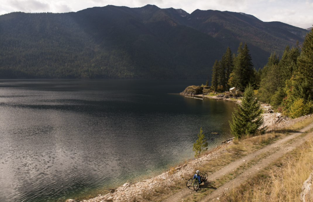
The Great Northern Rail Trail (48-km, one-way | 30-mi) runs between the village of Salmo in the south and the city of Nelson in the north. The railway was operated by Burlington Northern Santa Fe and in 1999, the final removal of the rails and ties was completed. It is a multi-use trail (gravel surface) which forms a section of the TransCanada Trail.
REVELSTOKE
Miller Time on Mount MacPherson in Revelstoke is a sweet short loop full of swoops and fun (1.1-km, return | 0.6-mi). Starting at the Griffin Creek Forest Service Road, approximately 6-km from the city centre, Miller Time offers a trailhead equipped with an informational kiosk, picnic table, and amenities. This 1-km loop on the western slopes of the Columbia Valley provides an excellent representation of the lush interior rainforest.
SLOCAN VALLEY
The Slocan Valley Rail Trail, between Slocan and Crescent Valley, offers easy access to 50-km, one-way (31-mi) of breathtaking scenery. The trail follows the contours of the Slocan River, between Slocan Lake in the north to the Kootenay River in the south.
ACCESSIBLE ROAD TRIP
This circle route includes the entire region. It showcases the Kootenay Rockies’ communities and the accessible attractions and activities they offer. You can start touring along this route anywhere you like or simply check out the community or national park of your choice. Along your journey, you will discover rare, scenic vistas and meet warm friendly people.